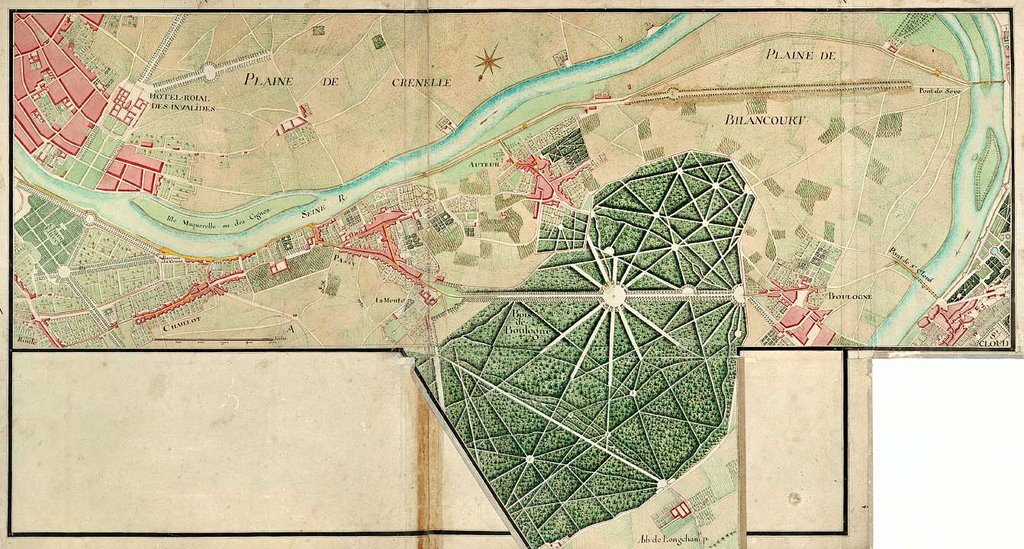
Portion de route longeant la Seine près des Champs-Elysées

Portion de route à partir de la barrière de 'Louis-le-Grand' à la 'Grande-Pinte'
allant à 'Saint-Ouen', avec embranchement de la chaussée de Clichy
allant à 'Saint-Ouen', avec embranchement de la chaussée de Clichy
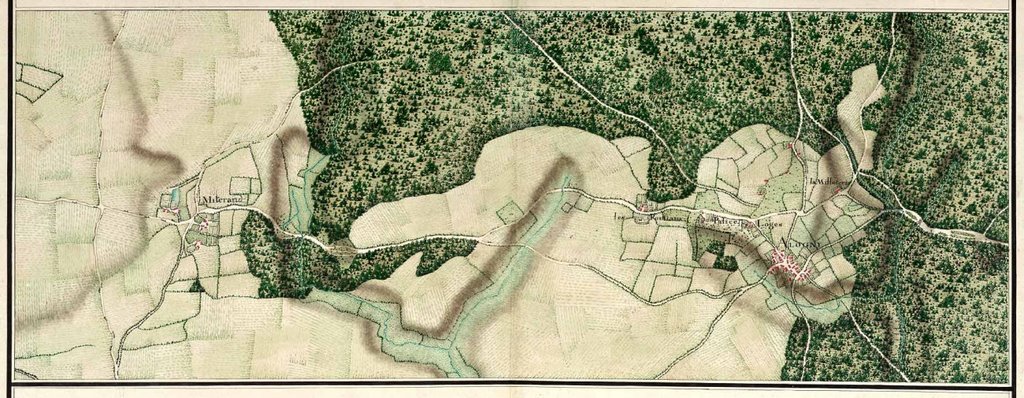
Généralité de Bourges n° 9 Portion de route entre Mitterand et Allogny

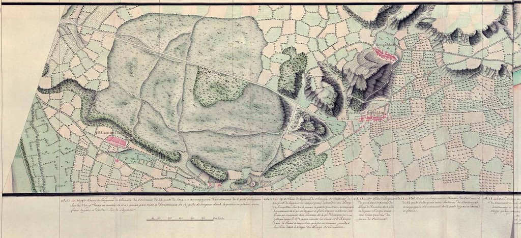
Cartes de la route de Caen en Bretagne depuis
Villedieu jusqu'à Pontorson et Villecherel, 1749
Villedieu jusqu'à Pontorson et Villecherel, 1749

La Généralité de Hainaut-Cambrésis

La Généralité de Caen. Numéro 8.
La Généralité de Lyon Le-Péage-de-Roussillon

La Généralité de Lyon - Depuis Saint-Vallier à Thain

La Généralité de Lyon. n° 1.
Généralité de Lyon n° 9

La Généralité de Châlons - Sainte-Menehould
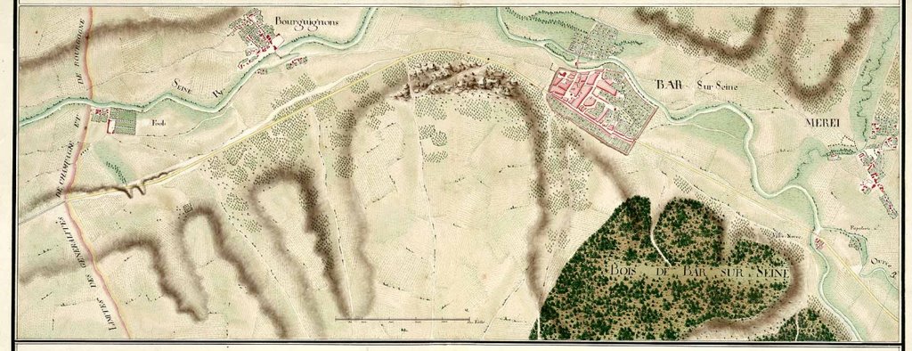
La Généralité de Châlons - Bar-sur-Seine

La Généralité de Châlons

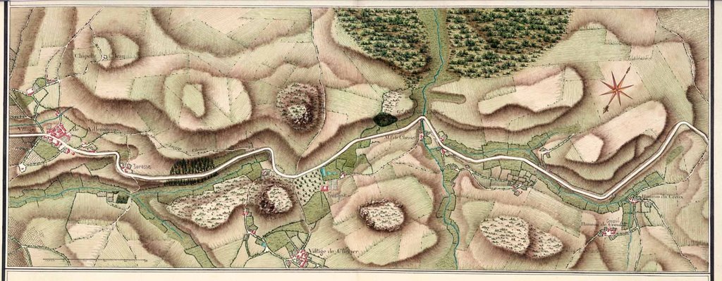
Route de La-Charité à Auxerre depuis Mêves,
jusqu'à la fin de la généralité de Berry en passant par Donzy.'
jusqu'à la fin de la généralité de Berry en passant par Donzy.'
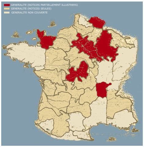
Available illustrated areas of the atlas online (dark brown) Bourges (41 images),
Caen (32 images), Chalons (106 images), Hainaut-Cambrésis (87 images),
Lyon (39 entries, several multiple), Paris (11 images).
Caen (32 images), Chalons (106 images), Hainaut-Cambrésis (87 images),
Lyon (39 entries, several multiple), Paris (11 images).
[click images above for larger versions]
The National Archives of France offers a geneorous sampling from a collection of more than 3000 manuscript maps (62 volumes) of the roads and country side of France made by Charles Daniel Trudaine between 1745 and 1780. Each volume covers one or more parts of France according to the election regions under the Ancien Régime.
Trudaine was the Financial Quartermaster to King Louis XV and one of founders of the famous French school of the Departement of Civil Engineering (L'école des Ponts-et-Chaussées).
The maps themselves are highly detailed and were originally commissioned to plot the royal roads. But they constitute a significant and broad 18th century historical corpus, documenting parks, churches, convents, cemeteries, ruins, castles, waterways and essential geophysical features in the landscape.
I noted in passing that the 'Atlas de Trudaine' is being used as a source landscaping document in the enormous architectural survey [translation] being carried out in France over the next few years by ERHAM ('Équipe de Recherche sur l'Histoire de l'Architecture Moderne') at Centre André Chastel at Sorbonne University. That's in addition of course to its simply being beautiful cartographic artistry. [via Lexilogos] (Previously: 5 centuries of Champagne cartography)


No comments:
Post a Comment