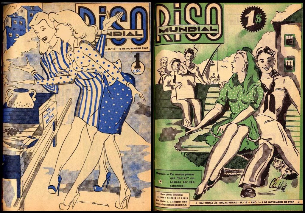
 These two 'Riso Mundial' magazine covers from 1947 come from the
Lisbon Hemeroteca Digital project in Portugal. I haven't had a good
look through the site which features periodical publications.
(via the sidebar at: A Arte Moderna)
 Watercolor illustration of the Toltec Calendar [19th century] in the
Mexico Collection among the Yale University Library manuscript offerings
{reminder from things}.
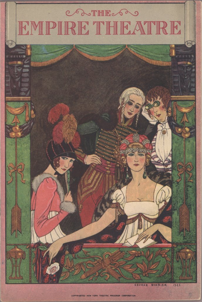 New York's Empire Theater program cover from 1922 by George Barbier
somewhere among the Joseph Urban collection at Columbia University.
 Two advertisements (1910 & 1932) from:
Exposición del Centro Virtual Cervantes Sobre el Arte Publicitario Español.
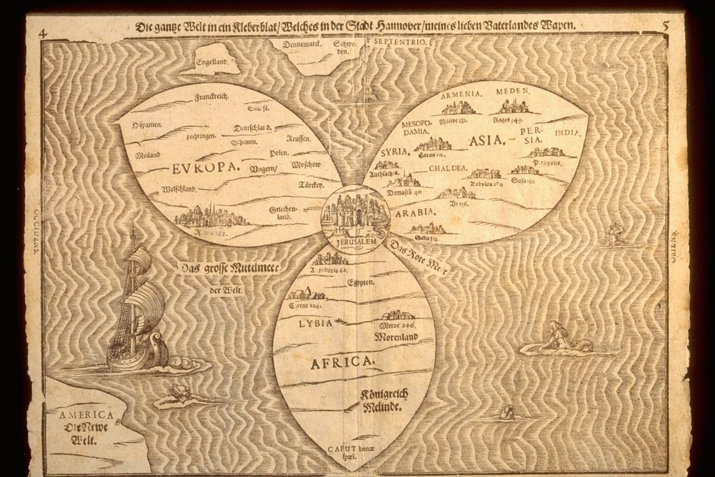
 One of the most famous and eccentic world maps ever made,
'Die Gantze Welt in ein Kleberblat' by Heinrich Bünting first
appeared in 1581 in a geobiblical book called 'Itinerarium Sacrae Scripturae'
('Travels according to the Scriptures'). More than 60 editions were published.
Jerusalem is depicted at the centre of the world, in accordance with a
biblical passage from Ezekiel. The uncoloured version is from the
Jerusalem-3000 site at the University of Southern Maine
and the other is at Oldworldauctions (the map by itself sold for $8,500)
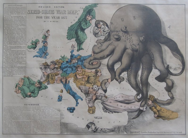 This Serio-Comic War Map for 1877 with Russia as the octopus is at all the
usual cartographic haunts online (eg. Barron Maps, British and other libraries &c)
 Maslen's map of the mythical inland sea of Australia.
In the early 19th century, with the majority of the non-coastal areas of
Australia still unexplored, the commonly held misconception was that central
Australia must have an inland sea and major river system. The belief was at its
highest following the publication in 1827 of 'The Friend of Australia' by a retired
East India Company employee, Thomas J Maslen. His map, or at least the inland sea,
adjoining river and the labelled locations of 'Australindia' and 'Anglicania' parts,
are pure fantasy. Maybe it would have helped his accuracy if he visited Australia.
The true picture of the outback geography emerged over the next couple of decades.
I had never known of this map's existence until just recently.

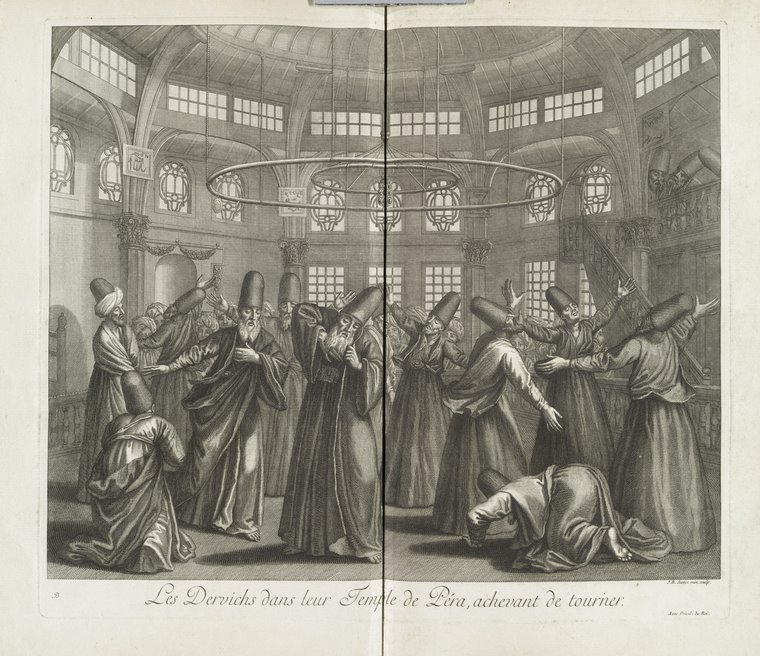 'Les Dervichs dans leur Temple de Péra Achevant de Tourner' in
'Recueil de Cent Estampes Representant Differentes Nations du Levant' 1714.
The engraving was done by Jean-Baptiste Scotin and from memory the book
has illustrations of customary dress for middle eastern peoples: interesting,
but this image was, to me, the most remarkable. I had hoped to collect enough
images for a post on Sufism/Dervish dancing but I didn't find much else - searching
for images relating to specific subject matter is not always an easy task. I have
no recollection as to where the colour version came from (possibly via google images).
The black and white image is somewhere in NYPL.
 A frontpiece from 'Der Raupen Wunderbare Verwandlung und Sonderbare'
1679 by the amazing Maria Sibylla Merian - randomly found somewhere in the
University of Frankfurt.
 'Reading for the Privileged Few' 1999
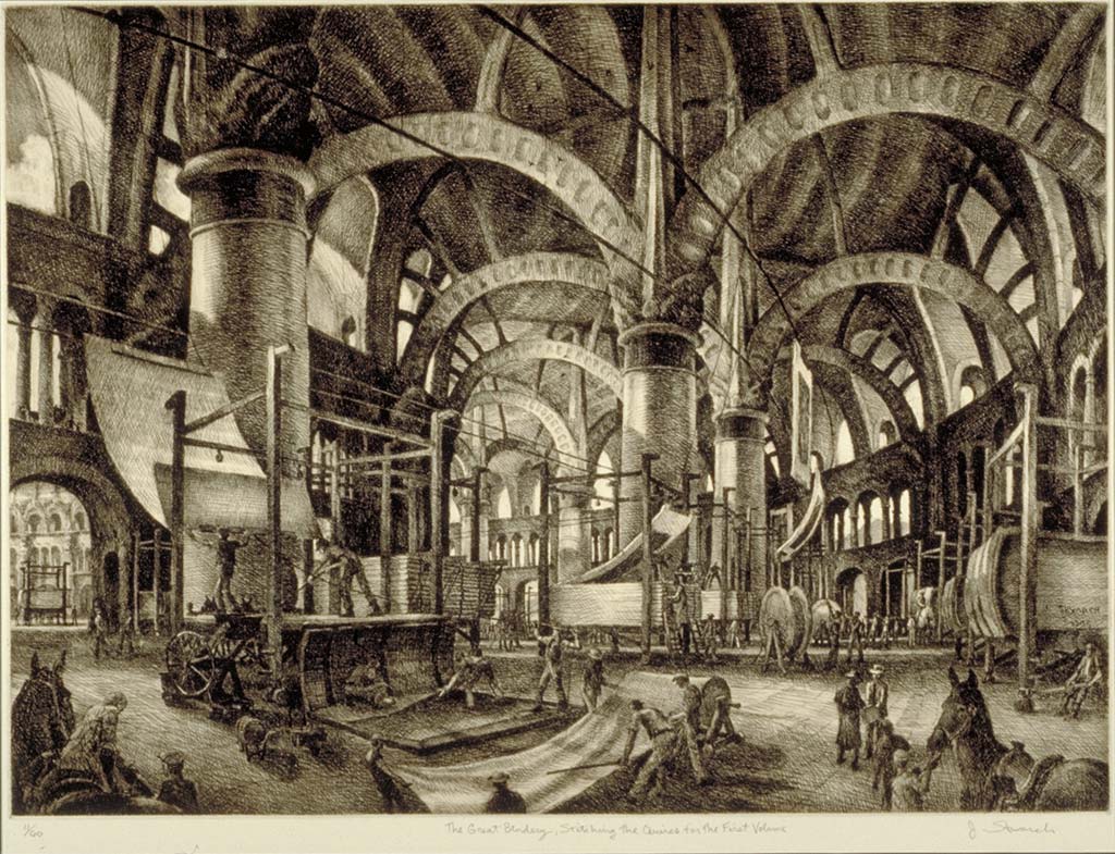 'The Great Bindery' 1996
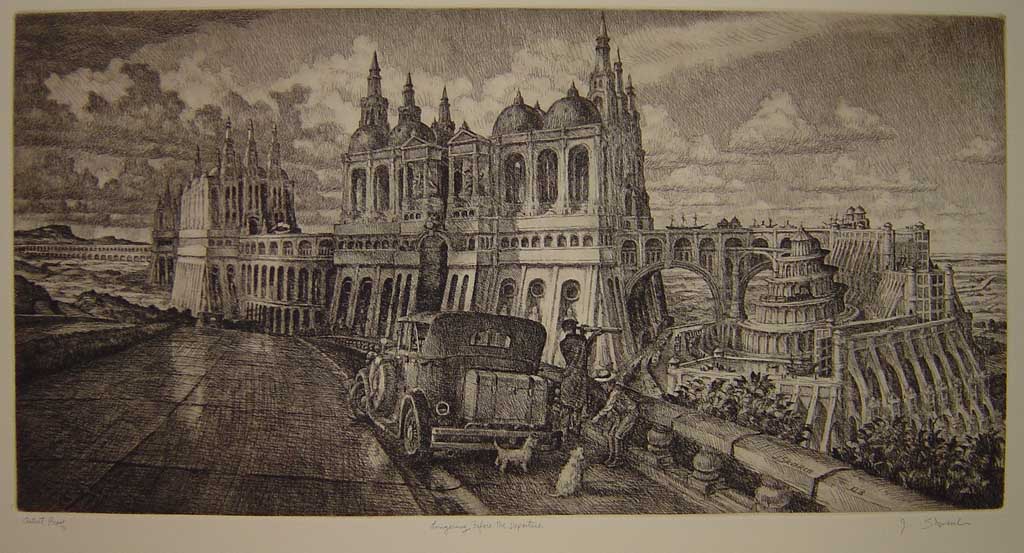 'Lingering Before Departure' 2003
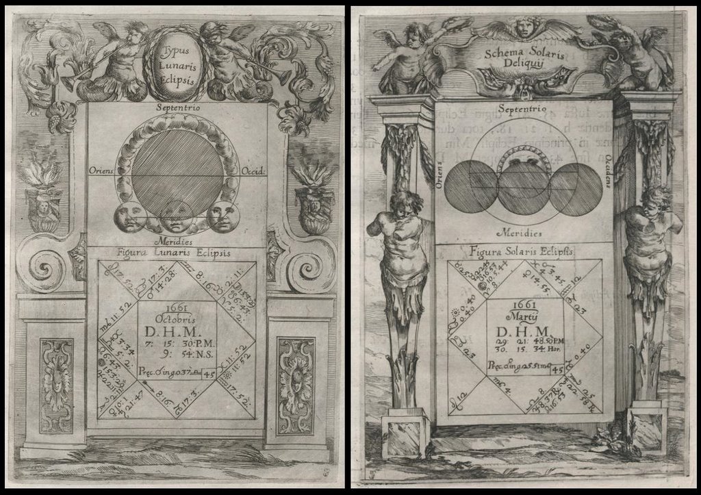 Lunar and Solar eclipse calendars or prediction charts by Cornelio Malvasia
1662 from his 'Ephemerides Novissimae Motuum Coelestium'
at the University of Bologna digital book collection.
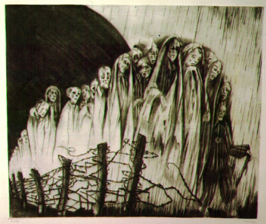 'The Rumor'
Engraving by Fritz Lederer 1946 from his series:
'In the Eruv of Theresienstadt' - part of the 'Artistic Responses
to the Holocaust and Genocide' section at the extensive
Virtual Museum of The Center for Holocaust and Genocide Studies.
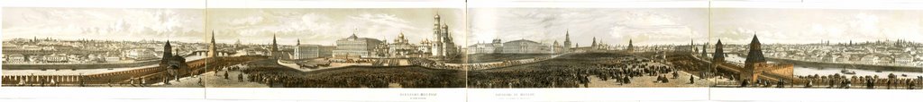 This is an impressive panoramic view of Moscow during a 19th century
royal coronation ceremony . The lithographer's name looks like 'Villea'
but it's not quite clear. Click on the picture for a slightly larger version.
The image comes from somewhere in Martin Luther University in Halle, Germany. [view
 The creator of this outstanding magnolia painting has not been identified.
It belongs to the Ethelind Pope Brown Natural History Collection
at South Carolina University. The 32 works on display are some of
the oldest known depictions of South Carolina flora and fauna.
 'Pangur Ban'
A traditional yet contemporary rendering
of a 9th century Irish poem © Denis Brown.
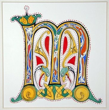
 'Brendan: The First Voyage, Womb to World'
Calligraphic Glass Art © Denis Brown 2002.
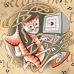 I suppose the best way to describe Denis Brown is as an experimental calligrapher. Definitely go and visit his Quillskill site and have a good look around. There is enough there to whet the appetite and leave you wanting more. Outstanding work. I hope he uploads some film of a proposed performance art calligraphy duet with a cellist. It's not just me that is wrapped in his work (he sells most of his work to other Irish calligraphers, so he says) - he has just been awarded a grant by the Crafts Council of Ireland in relation to architectural calligraphy works.
The Quillskill site of Denis Brown comes via Beth Lee's calligraphy/bookart site - her rendering of a detail from the 7th century Lindisfarne Gospels appears below.
 'Real', a fabric artbook © Linda Grashoff who combines paint,
photography and sewing to produce her artist books. The gallery
page is from Fiberarts Magazine via Fabric Art Journals.
 'A Souvenir of San Francisco - Within the Golden Gate'
by Laura Young Pinney. Illustrated by Ella M Pierce 1893. The
book is available as a pdf download from this page at Archive.org.
Click on all the images for larger or much larger versions.


No comments:
Post a Comment